[장선희 기자 = 경기북부/강원] 지난 2019년 11월부터 2021년 12월까지, 고성군은 총35억(국비 21억 군비11억)을 들여, 관내 총 668,178km의 지상 및 지하시설물 정보를 전산화하여 시스템을 구축하고, 올해 2022년 2월부터 '지하시설물 통합정보시스템'을 오픈하여 운영 중이라고 밝혔다.
지하시설물 통합정보 시스템은 그간 종이도면 및 개별 전산자료로 관리되던 자료들을 통합하고 공공측량을 통해 지상 및 지하시설물의 정확한 위치와 속성정보를 전산화한 시스템이라고 했다.
지하시설물 통합정보시스템은 각종 건설 과정에서 발생할 수 있는 도시재난과 사고(화재, 지반침하, 상수도 파손 등)에 효과적으로 대응할 수 있는 안전한 기반을 마련하며, 각종 정책결정 수립 및 인허가 과정에 중요한 기초 자료로 제공되지만, 지하시설물 통합정보 자료는 국가공간정보 보안관리규정에 따른 공개제한 정보로 일반 군민에게 직접 제공되지는 않는 자료이나, 학술연구 및 공공복리 및 안전등의 공공목적을 위한 사업에는 심의를 통해 제공이 가능하다고 전했다.
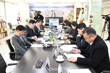
지하시설물 통합정보시스템의 활용이 우선되는 담당 2개부서 16명에 대해 우선적으로 프로그램 및 보안관련 사용자 교육을 실시하였으며, 연중(2월~10월) 매월1회 부서별 담당자 교육을 실시할 예정이라고 했다.
군 관계자는 "지하시설물 통합정보시스템의 활용으로 각종 인허가 및 기타 도로 및 상하수도 행정(정책) 결정시, 좀 더 합리적인 의사결정이 가능해짐에 따라 질적인 민원서비스 향상이 기대된다." 라고 밝혔다.
*아래는 위 기사를 '구글 번역'으로 번역한 영문 기사의 [전문]입니다. '구글번역'은 이해도를 높이기 위해 노력하고 있습니다. 영문 번역에 오류가 있을 수 있음을 전제로 합니다. *The following is [the full text] of the English article translated by 'Google Translate'. 'Google Translate' is working hard to improve understanding. It is assumed that there may be errors in the English translation.
Goseong-gun operates 'Unified Information System for Underground Facilities'
A system that computerized the exact location and attribute information of ground and underground facilities
[Reporter Jang Seon-hee = Northern Gyeonggi/Gangwon] From November 2019 to December 2021, Goseong-gun spent a total of 3.5 billion won (national budget of 2.1 billion won) and computerized information on a total of 668,178 km of ground and underground facilities. The system was established, and the integrated information system for underground facilities has been opened and operated since February 2022.
The integrated information system for underground facilities is a system that integrates data that had been managed with paper drawings and individual computer data, and computerized the exact location and attribute information of ground and underground facilities through public surveying.
The integrated information system for underground facilities provides a safe foundation to effectively respond to urban disasters and accidents (fire, ground subsidence, damage to water supply, etc.) However, the information on integrated underground facilities is information that is restricted from disclosure in accordance with the National Spatial Information Security Management Regulations and is not directly provided to the general public, but is provided through deliberation for projects for public purposes such as academic research and public welfare and safety. said this is possible.
Program and security-related user education was given priority to 16 people in two departments in charge of using the integrated information system for underground facilities. .
A military official said, "Usage of the integrated information system for underground facilities will enable more rational decision-making when making various licensing and other road and water and sewage administrative (policy) decisions, so the quality of civil service is expected to improve." said.
이 기사 좋아요
<저작권자 ⓒ 브레이크뉴스 경기북부 무단전재 및 재배포 금지>

댓글
장선희 기자, 고성군, 지하시설물 정보, 전산화, 시스템 구축, 지하시설물 통합정보시스템, 운영 관련기사목록
|
많이 본 기사
많이 본 기사
|


