영월군, 위성측량 등 최신 측량기술로...디지털 지적공부 완료
내덕8지구 등 9개지구 3,075필지 지적현황 불부합 해소
영월군, 위성측량 등 최신 측량기술로...디지털 지적공부 완료내덕8지구 등 9개지구 3,075필지 지적현황 불부합 해소
[김준호 기자=영월군] 영월군은 소하천 물길의 변동, 광산지역 밀집 주거단지의 점유면적 경계 불부합 등 토지의 이용현황과 지적도면이 불일치한 지역인 상동읍 내덕 8, 9지구 등 9개 지구에 대한 지적재조사 경계결정을 확정하고 새로운 디지털 지적공부를 작성했다.
이번에 확정된 지적재조사지구는 상동읍 내덕리 2개 지구, 산솔면 연상리 3개 지구, 직동리 2개 지구, 북면 공기리 1개 지구, 남면 북쌍리 1개 지구이다.
이번 지적재조사를 통해 실제 현황과 지적도면을 일치시킴으로써 수 십년 간 재산권 행사에 제약을 받아왔던 민원을 해결할 수 있게 되었다.
지적재조사 사업은 100여년 전 일제 강점기에 낙후된 기술로 만든 종이 지적도를 위성측량 등 최신 측량기술로 조사‧측량해 디지털 지적으로 전환하는 국책사업으로 2030년까지 연차적으로 추진하고 있다.
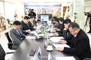
김경민 영월군청 종합민원실장은 "이번에 시행되는 지적재조사측량은 토지소유자가 경계 확인에 따른 측량비용을 절감하고 측량기술 발전, 행정신뢰도 향상 등의 효과를 거둘 것으로 기대한다."라고 말했다.
한편, 영월군 관계자는 현재 진행중인 11개 지구도 일필지 조사측량 완료에 따른 경계협의 등 70%의 공정율로 원활하게 진행되고 있어 2023년 말까지 경계결정을 완료할 계획이다.
*아래는 위 기사를 '구글 번역'으로 번역한 영문 기사의 [전문]입니다. '구글번역'은 이해도 높이기를 위해 노력하고 있습니다. 영문 번역에 오류가 있을 수 있음을 전제로 합니다. *The following is [the full text] of the English article translated by 'Google Translate'. 'Google Translate' is working hard to improve understanding. It is assumed that there may be errors in the English translation.
[Reporter Kim Joon-ho = Yeongwol-gun] Yeongwol-gun points out nine districts, including districts 8 and 9, Naedeok, Sangdong-eup, which are areas inconsistent with land use status and cadastral maps, such as changes in small river waterways and inconsistency in occupied area boundaries of densely populated residential complexes in mining areas. The reinvestigation boundary decision was finalized and a new digital cadastral study was drawn up.
The cadastral resurvey districts confirmed this time are 2 districts in Naedeok-ri, Sangdong-eup, 3 districts in Yeonsan-ri, Sansol-myeon, 2 districts in Jikdong-ri, 1 district in Gonggi-ri, Buk-myeon, and 1 district in Bukssang-ri, Nam-myeon.
Through this cadastral resurvey, it was possible to resolve civil complaints that had been restricted from exercising property rights for decades by matching the actual situation with the cadastral drawings.
The cadastral resurvey project is a national project that converts paper cadastral maps made with outdated technologies during the Japanese colonial period more than 100 years ago with the latest surveying technologies such as satellite surveying into digital cadastral maps. It is being promoted annually until 2030.
Kim Gyeong-min, head of the Comprehensive Civil Affairs Office at Yeongwol-gun Office, said, "The cadastral resurvey survey conducted this time is expected to reduce surveying costs for land owners for boundary confirmation, develop surveying technology, and improve administrative reliability."
Meanwhile, an official from Yeongwol-gun plans to complete the boundary decision by the end of 2023 as progress is being made smoothly at a 70% progress rate, such as boundary consultation following the completion of one-lot survey and survey for 11 districts currently in progress.
이 기사 좋아요
<저작권자 ⓒ 브레이크뉴스 경기북부 무단전재 및 재배포 금지>

댓글
김준호, 영월군, 영월군청, 지적재조사, 디지털지적공부, 상동읍, 조사측량, 경계협의, 경계결정, 측량비용절감, 측량기술발전, 행정신뢰도, 지적재조사, 실제현황, 지적도면 관련기사목록
|
많이 본 기사
많이 본 기사
|


