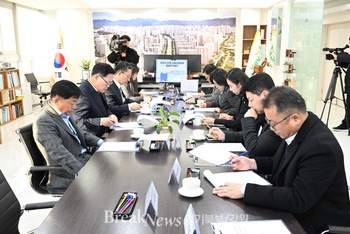
이번 강원도 산불은 10일 동안 발생한 재해로 산림 및 주택 등 피해가 심각하여 강원도는 신속한 복구 지원을 위해 국토교통부(국토지리정보원) 및 한국국토정보공사(강원지역본부)와 협업하여 강릉, 동해, 삼척, 영월, 4개 지역의 피해 면적 및 소유자 현황 등을 분석하고 관련 부서 및 시·군에 자료를 제공함으로써 산림복구 계획 등 재해복구 업무를 지원하게됐다고 했다.
강원도와 한국국토정보공사(강원지역본부)는 이번 달 3월 23일부터 피해 지역 내 주택지를 중심으로 드론 촬영을 실시하여 정사영상을 구축하고, 광범위한 임야지역은 국토교통부(국토지리정보원) 제공 위성영상을 활용하여 피해 현황 등을 신속하게 분석, 관련 부서에 제공하게 된다고 전했다.
이번 드론·위성 영상을 활용한 재해복구 지원은 3개 기관이 협업으로 추진하여 예산절감과 각종 피해 규모를 과학적으로 산정하는 등 효과적인 재난의 대응과 복구에 활용될 수 있을 것으로 기대하고 있다고 했다.
강원도 손형욱 토지과장은 각 기관이 협업으로 추진하는 만큼 “드론·위성 영상을 활용한 재해복구 지원에 최선을 다 하겠다”라고 밝혔다.
*아래는 위 기사를 '구글 번역'으로 번역한 영문 기사의 [전문]입니다. '구글번역'은 이해도 높이기를 위해 노력하고 있습니다. 영문 번역에 오류가 있을 수 있음을 전제로 합니다. *The following is [the full text] of the English article translated by 'Google Translate'. 'Google Translate' is working hard to improve understanding. It is assumed that there may be errors in the English translation.
Support for rapid disaster recovery by using drone and satellite images in Gangwon-do, forest fire-damaged areas
Utilization of state-of-the-art ICT-based unmanned aerial vehicles (drones)
[Reporter Hyeon-Woo Kim = Northern Gyeonggi/Gangwon] Gangwon-do announced that it would support disaster recovery by analyzing the damage situation using drone and satellite images for the rapid recovery of areas damaged by recent large-scale wildfires.
This Gangwon-do forest fire was a disaster that occurred for 10 days, and the damage to forests and houses was serious. In order to support rapid recovery, Gangwon-do collaborated with the Ministry of Land, Infrastructure and Transport (National Geographic Information Service) and Korea Land Information Corporation (Gangwon Regional Headquarters) to support rapid recovery in Gangneung, Donghae, Samcheok. , Yeongwol, and Yeongwol, analyzed the damaged area and owner status, and provided data to the relevant departments and cities/guns to support disaster recovery tasks such as forest restoration plans.
Gangwon-do and Korea Land Information Corporation (Gangwon Regional Headquarters) have built an orthographic image by shooting drones centered on residential areas in the affected area from March 23 this month, and satellites provided by the Ministry of Land, Infrastructure and Transport (National Geographic Information Service) for extensive forest areas. The video will be used to quickly analyze the damage situation and provide it to the relevant departments.
He said that the disaster recovery support using drone and satellite images is expected to be used in effective disaster response and recovery, such as budget reduction and scientific calculation of various damages through collaboration between the three organizations.
Son Hyung-wook, head of the land department in Gangwon-do, said, "We will do our best to support disaster recovery using drone and satellite images, as each organization is promoting collaboratively."
이 기사 좋아요
<저작권자 ⓒ 브레이크뉴스 경기북부 무단전재 및 재배포 금지>

댓글
김현우 기자, 강원도, 산불 피해지역의 신속한 복구, 드론.위성 영상, 재해복구 관련기사목록
|
많이 본 기사
많이 본 기사
|


